Rwanda is located in East Africa at the co-ordinates 2°00′S 30°0′E, bordering DR Congo, Tanzania, Uganda and Burundi.
Rwanda covers an area of 26,338 square kilometers, and it is ranked the world’s 149th-largest country.
Mean annual temperature for Rwanda is 19.1℃, with average monthly temperatures ranging between 19.5°C (September) and 18.5℃ (July).
Annual precipitation is 1,170.2 mm. Rainfall is experienced throughout the year in Rwanda, with most significant rainfall occurring from September to May.
Biogeography of Rwanda:
The country’s topography is mainly hilly giving it the name “Land of A Thousand Hills”
The highest point is Mount Karisimbi 4507 metres above sea level and the lowest point is the Rusizi River at 950 metres above sea level.
The country’s longest river is the Nyabarongo, which rises in the south-west, flows north, east, and southeast before merging with the Akanyaru to form the Kagera; the Kagera then flows due north along the eastern border with Tanzania. The Nyabarongo-Kagera eventually drains into Lake Victoria’
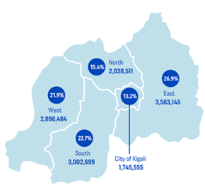
The country is divided into 5 provinces, namely, Eastern, Western, Northern, Southern provinces, and Kigali city
Rwanda’s administrative boundaries are divided into 30 districts
Population dynamics in Rwanda:
The country’s topography is mainly hilly giving it the name “Land of A Thousand Hills”
The highest point is Mount Karisimbi 4507 metres above sea level and the lowest point is the Rusizi River at 950 metres above sea level.
The country’s longest river is the Nyabarongo, which rises in the south-west, flows north, east, and southeast before merging with the Akanyaru to form the Kagera; the Kagera then flows due north along the eastern border with Tanzania. The Nyabarongo-Kagera eventually drains into Lake Victoria’
The country is divided into 5 provinces, namely, Eastern, Western, Northern, Southern provinces, and Kigali city
Rwanda’s administrative boundaries are divided into 30 districts
The UPSCALE project is conducted in Eastern Province, Gastibo district, Nyagihanga sector
Population dynamics in Gatsibo district
Gatsibo District has a population density of 270 persons per square kilometer.
The total population increased from 283,456 in 2002 to 433,997 according to the 2012 National Census provisional results
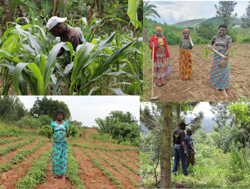
Agriculture in Gatsibo district.
Gatsibo district is one of the Sustainable Agriculture Intensification and Food Security Project (SAIP) intervention sites across Rwanda.
Agriculture production and livestock is the principal economic activity in Gatsibo District.
75.2% of the land is cultivated, fallow (4.7%), and pasture and non-agricultural land represent only 20.1%.
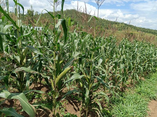
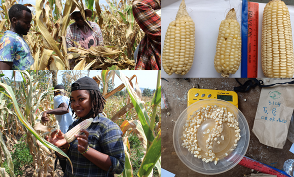
Main crop produced are cereals (maize and rice) representing 29.5% of cultivated land, followed by legumes and pulse at 28.5%, and bananas on 23.14%.
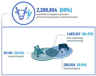
Livestock keeping is also an important source of income and food for agricultural households.
69.7% of Households in the Gatsibo district own livestock mainly cows
General overview of demographics, and agriculture in the Nyagihanga sector
Area of 71.93 km²
Population of 28,812 inhabitants (2022 census)00.6/km² Population Density [2022] 1.8%
6129, farming households
The average field size is 0.5 Ha
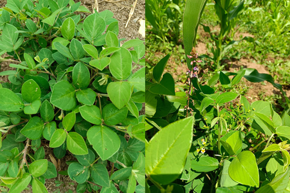
Main crops are maize, beans, bananas, coffee, sorghum, vegetables, soybeans, groundnuts,
Main Cropping practices in the area are mixed maize and beans, rotation of sorghum and beans, mixed beans and bananas, and rotation of maize and Irish potatoes.
Farmers keep livestock such as goats, pigs, and a few modern cows producing < 10 litres of milk and chickens. Very few traditional cows.
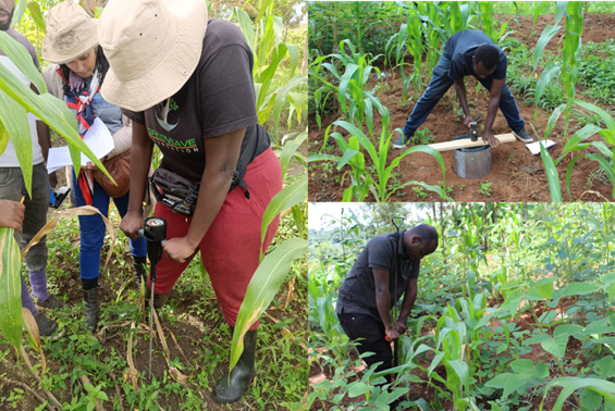
Key challenges facing the farmers in Nyagihanga (pests, erosion, water, land tenure, farm sizes)
Poor soil infiltration especially after heavy rain that happens in the months of March and April.
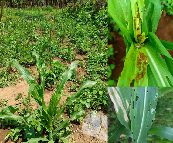
Pests; Stem borers, fall armyworm in cereal crops
Drought, resulting in livestock eating all grasses including desmodium and brachiria during the dry season.
Bad road to transport the harvest to the markets.
Many households are remote thus far from the marketplaces.
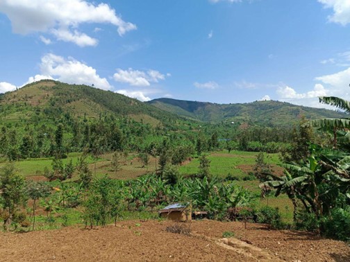
The landscape is highly mountainous, leading to frequent soil erosions, and mudslides.
Inadequate access to water especially for households living and cultivating up the mountains.
Limited farming areas, most of the farmers possess < ½ ha of land, thus limiting crop diversification, in turn restricting the household’s access to a balanced diet
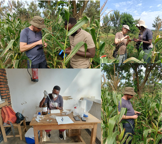
Since when was push-pull introduced, how many farmers have been using/ trialling it, and what key challenges does it involve?
Push-pull was introduced towards the end of 2017 with ICIPE in collaboration with the Food for the Hungry organization and the Rwanda Agricultural Board.
In 2018, about 47 lead farmers were trained and became Trainers of Trainers (T.o.T)
The farmers embraced the technology in response to fighting stem borers and fall armyworm pests.
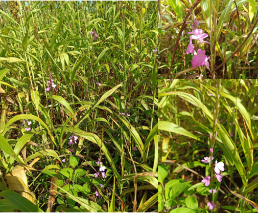
Desmodium and Brachiaria became popular amongst livestock farmers as well due to their highly nutritious components as farmers witnessed an increase in the quantity of milk from their cows
Currently, 750 farmers practicing push-pull technology in Nyagihanga as per the previous planting season in 2023.
Key challenges in push-pull technology
Some species of desmodium dry up quickly during the dry season,
The high cost of desmodium and brachiaria seeds became a barrier to the participants to scale the technology.
Travelling long to the big city to get desmodium and brachiaria seeds because they are not easily found in the local input stores; or agro-dealers.
Less number of livestock to help farmers get organic manure.
Crop rotation, forcing farmers to uproot the desmodium to plant edible intercrop
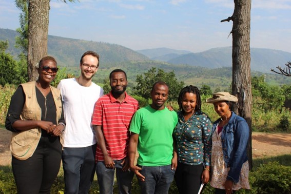
Members of the field team in Rwanda. From Left: Grace M. Amboka, Adomas Liepa (Ph.D. students in the UPSCALE project), Francois Mutuyineza, Jean de Dieu Habarurema, Neema Uwizeye, and Delphine Yandereye.
We use cookies on our website to give you the most relevant experience by remembering your preferences and repeat visits. By clicking “Accept”, you consent to the use of ALL the cookies.
This website uses cookies to improve your experience while you navigate through the website. Out of these, the cookies that are categorized as necessary are stored on your browser as they are essential for the working of basic functionalities of the website. We also use third-party cookies that help us analyze and understand how you use this website. These cookies will be stored in your browser only with your consent. You also have the option to opt-out of these cookies. But opting out of some of these cookies may affect your browsing experience.
Necessary cookies are absolutely essential for the website to function properly. This category only includes cookies that ensures basic functionalities and security features of the website. These cookies do not store any personal information.
Any cookies that may not be particularly necessary for the website to function and is used specifically to collect user personal data via analytics, ads, other embedded contents are termed as non-necessary cookies. It is mandatory to procure user consent prior to running these cookies on your website.